

Features LINZ Geodetic Marks
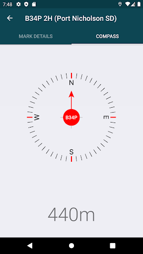
Use the app to navigate to New Zealands geodetic marks.
You can also submit updated mark photos and other information to LINZ.
The app also includes important non-geodetic marks that may need to be protected when road and footpath works, trenching and other similar activities are being carried out.Key features:- Find geodetic marks and other key non-boundary marks- Navigate to marks using compass and distance, or Google Maps- Access mark details, access diagrams and photos- Submit updated mark details and photos to LINZ- Advise LINZ of mark maintenance issues- Create and save mark groups- Identify nearby PositioNZ GNSS stations- Toggle display between horizontal and vertical marks- Filter displayed marks by coordinate order and beacon typeYou can find out more about New Zealands geodetic marks at http://www.linz.govt.nz/gdb
Secure & Private
Your data is protected with industry-leading security protocols.
24/7 Support
Our dedicated support team is always ready to help you.
Personalization
Customize the app to match your preferences and workflow.
See the LINZ Geodetic Marks in Action


Get the App Today
Available for Android 8.0 and above